A record of methods, measurements, and reference frames.
Search Scott Stubbs’s public paper archive by title, abstract, research area, or source category. Every PDF action points to the original Academia.edu record.
Showing 18 papers
Reference Frames
The Local Tangent Plane as Primary Methodological Reference: Evidence that Curvature Constitutes a Secondary Computational Insertion in Aircraft Dynamic and Tracking Models
Technical literature in aerospace dynamics and target tracking consistently initiates models from a flat or local-tangent-plane reference frame. This paper examines that practice through primary sources-Crouse (2015), Stewart et al. (2010), and multiple NASA technical reports-and argues that the local tangent plane functions as a topographical, stationary planar surface in operational modelling. Ellipsoidal curvature terms appear only as subsequent adaptations. The analysis treats the local planar frame as the default computational baseline and the insertion of curvature as a post-processing construct rather than a primary empirical observation.
Concorde routinely operated at cruise altitudes of 50 000-60 000 ft. Its sole continuous highprecision position and attitude measurements were produced by three independent Litton LTN-51 Inertial Navigation Systems (ARINC 561). These systems do not deliver model-free observations. From the first second of alignment they require mandatory insertion of present position, apply Earth-rate compensation calculated from that latitude, and maintain Schuler tuning based on an assumed Earth radius. A NASA technical paper that used a production-family LTN-51 states that the internal calculations assume a spheroidal Earth with flattening ratio 1:297 and a Schuler period of 84.4 minutes. Official British Airways limitations further restrict alignment to latitudes ≤ 76° and require the aircraft to remain stationary during the ALIGN mode. Visual horizon reports remain qualitative and uncalibrated. This paper identifies the actual airborne measurements, documents every reference-frame insertion, and treats the ellipsoidal and rotational parameters as imposed computational constructs rather than independent physical observations.
The Validation and Refill Architecture of GRACE and GOCE
The Gravity Recovery and Climate Experiment (GRACE) and Gravity field and steady-state Ocean Circulation Explorer (GOCE) missions are widely presented as satellite-only determinations of Earth’s gravity field. Examination of primary source documents reveals two structural features that complicate this narrative. First, pre-launch planning documents and post-mission high-resolution models explicitly incorporate airborne and terrestrial gravity data—particularly NIMA/NGA Arctic Gravity Project measurements—as calibration, validation, and densification layers. Second, the GRACE attitude and orbit control system relied on cold-gas nitrogen thrusters whose propellant accounting, consumption rates, and long-duration maintenance are absent from the official launch documentation, despite a mission lifetime more than three times the design specification. These patterns parallel the documented use of airborne reference data in the ICESat/IceBridge system. The combined evidence indicates that the final high-resolution gravity products of the GRACE/GOCE era were hybrid constructs whose short-wavelength content and operational longevity rest on lower-altitude systems and unelaborated propellant margins.
Gadreel, the Retreated Light, and the Architecture of Containment: A Unified Interpretive Framework from the Watcher Betrayal to the Throne at Polaris
This paper constructs a single interpretive framework that begins with the Watcher named Gadreel in 1 Enoch 69:6 and traces a continuous current of containment through the retreat of primordial luminosity, the blood economy, linguistic inversion, institutional history, and a full cosmological architecture. Gadreel (Gader-El, "Wall of God") is identified as the agent who led Eve astray. Eve, originally luminous, lacked reflective self-knowledge and therefore could not see herself for who she was. Exploiting that vulnerability, Gadreel employed the mycelial network to relocate her light into a magnetic center within the human form-the pineal gland and deep cortex-where it remains residualized as endogenous N,N-dimethyltryptamine (DMT). Peer-reviewed research confirms that the mammalian brain expresses the necessary biosynthetic enzymes, maintains extracellular DMT at levels comparable to canonical monoamine neurotransmitters, and produces a significant DMT surge at cardiac arrest independent of the pineal (Dean et al., 2019; Christian et al., 1977). The residual store is finite. The subsequent creation of carnivorous animals and the industrialization of meat production established a permanent blood economy in which exogenous DMT from slaughtered animals triggers further release of the human endogenous store, functioning as a continuous microdose that diminishes residual light. The same current appears in linguistic inversion (Gad-El becoming the common name "God"), in the geometric distinction drawn by Albert Pike between plane geometry and spherical trigonometry, in the Custodial model of William Bramley, and in a long institutional lineage running through Cainites, Rome, the Templars, monarchy, Freemasonry, and the tripartite structure of Vatican-London-Washington. Cosmologically, Earth is situated within a dielectric Bloch domain wall. The Wall is real yet not impenetrable. Polaris is the Throne of Yahuah Most High. From that Throne the residual light rises by silent inner speech, and the land beyond the Wall will be revealed. The paper integrates primary texts, laboratory data, alternative historical models, and the full cosmological transmission into one coherent instrument for research and restoration.
This paper presents a technical analysis of the processes used to validate and produce satellite-derived bathymetry, with primary focus on NASA's ICESat-2 ATLAS instrument and the Experimental Advanced Airborne Research Lidar-B (EAARL-B). Drawing on peer-reviewed validation studies, official USGS technical reports, algorithmic reviews, and national bathymetric archives, three clear correlations are demonstrated. First, the foundational scientific validation of ICESat-2 bathymetry was performed against high-resolution airborne lidar data collected from a conventional aircraft. Second, raw bathymetric observations from airborne lidar and multi-beam sonar systems frequently appear near-planar over regional baselines before post-processing. Third, geoid undulation modeling systematically introduces curvature into these surfaces. Quantitative accuracy metrics, system specifications, and processing workflows are presented to establish these correlations with concrete evidence.
The Giza Pyramids as a Precessional Celestial Timestamp: Evidence from Stellar Altitudes, Pyramid Texts, and the Prague Astronomical Clock
The three main pyramids at Giza were positioned to record the configuration of Orion's Belt at its lowest point in the precessional cycle, approximately 10,450 BC. Since that epoch, the altitude of Al Nitak has shown a measurable and continuous increase when observed from the same fixed terrestrial location. This observable shift constitutes direct evidence of celestial motion relative to a stationary planar reference frame. The ancient Pyramid Texts describe a consistent cosmology of a motionless central plane beneath a moving celestial dome. This framework is mechanically confirmed by the Prague Astronomical Clock (1410), which operates with a fixed central reference and all celestial indicators in motion around it. Together, textual, monumental, and mechanical evidence supports the interpretation that the Giza complex preserves a deliberate astronomical record of a stationary planar Earth beneath a slowly rotating celestial field.
The Local Tangent Plane as the Primary Methodological Reference Frame: Evidence from Geodesy, Surveying, and Computational Modeling
Technical practice in geodesy, surveying, remote sensing, and engineering simulation consistently employs the local tangent plane as the default computational and operational reference. This paper reviews documented workflows and algorithms across these domains and identifies a recurring pattern: local planar frames serve as the starting reference, while global ellipsoidal or geoidal models are applied secondarily for data transformation or localized correction. Evidence is drawn from GNSS-R geometry algorithms, professional site calibration standards, finite element analysis procedures, radio interferometric imaging, local geoid modeling studies, and inertial navigation systems. The accumulated record indicates that the methodological priority of the local tangent plane is embedded in operational practice, independent of broader claims regarding the Earth's global shape.
The Hubble Stratospheric Continuity Hypothesis Technological Lineage from Airborne Observatories to the Presented Hubble Space Telescope Program
Primary NASA and DLR technical documents, operational testimony, image-processing records, and EVA training protocols demonstrate that the Hubble Space Telescope represents technological and operational continuity with high-altitude stratospheric platforms, most directly the Stratospheric Observatory for Infrared Astronomy (SOFIA). Mirror aperture, shared observational targets, dynamic scheduling constraints, absence of onboard orbital propulsion, and neutral-buoyancy training align with an airborne platform model rather than an independent rigid spacecraft in vacuum orbit. Public imagery results from centralized post-processing of raw high-altitude detector data. This paper integrates SOFIA program technical papers, the 2010 dynamic scheduling survey, the 2009 EVA training analysis, and recorded NASA operational testimony to establish the continuity hypothesis.
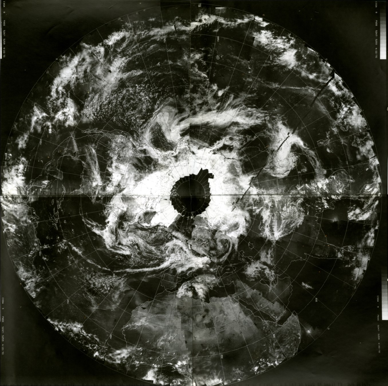
This paper examines the historical and technical record of early “satellite” programs, focusing on the transition from the openly documented inflatable platforms of Project ECHO (1960–1968) to the subsequent operational weather-observation systems (TIROS and ESSA series). Drawing on declassified CIA technical memoranda, IGY reports, Goldstein’s perturbation theory, and the full corpus of modern propulsion and attitude-control literature, the analysis argues that the engineering solutions employed across these programs exhibit continuity with high-altitude buoyant gas-envelope technology rather than a paradigm shift to rigid vacuum spacecraft. Particular attention is given to the “refill dilemma”—the absence of documented pressure-maintenance operations in long-duration platforms such as Himawari-8/9—and its proposed resolution through cold-gas blow-down, micro-thrust, and drag-free control architectures. The paper further argues that the official narrative of an undocumented aeronautical leap performed by RCA obscures the maturation of a single underlying technology: pressurized, steerable platforms operating persistently above the planar surface.
Empirical Reinterpretation of High-Altitude Balloon Telemetry: Evidence for Planar Geometry in Raw NASA Scientific Balloon Program Data
Raw GPS telemetry from eight recent NASA Columbia Scientific Balloon Facility (CSBF) flights at Fort Sumner, New Mexico, was analyzed without any spherical or geoid corrections. Linear regression on local planar coordinates yields R² values of 0.99979-0.99995, with observed altitude deviations of only 9-24 m over horizontal distances of 175-240 km. Globe-model curvature predictions are exceeded by more than an order of magnitude. These results are independently corroborated by peer-reviewed NASA/CSBF flights from the same launch site. The data support the Planar Earth methodological claim that raw empirical measurements operate on a flat, stationary baseline, with spherical corrections applied only in post-processing. The full analysis is reproducible from public archives.
Nasa Operation Icebridge MCoRDS Airborne Radar Data Evidence Of Post-Measuremen T WGS84 Ellipsoid Referencing And Geometric Corrections
Airborne ice-penetrating radar systems such as the Multi-Channel Coherent Radar Depth Sounder (MCoRDS) flown during NASA Operation IceBridge collect raw slant-range echo profiles in real time. Official CReSIS processing documentation demonstrates that these raw measurements are generated under local planar or layered-media assumptions with no real-time curvature correction, no motion compensation in early products, and no WGS84 ellipsoid referencing. All major geometric transformations-including motion compensation for attitude and lever arm, SAR focusing via f-k migration, and full geolocation referenced to the WGS84 ellipsoid-are applied exclusively during post-flight L1B processing. This post-measurement integration of global reference frames has important implications for the interpretation of polar remote-sensing datasets and the geometric assumptions embedded in published ice-sheet models.
Analysis Of Artemis Ii Flight-Derived Ephemeris Planar Geocentric Operational Baseline With Post-Measurement Geoid And Spherical Corrections
The official flight-derived ephemeris for Artemis II (NASA BET product, April 10, 2026) is examined after systematic removal of all post-measurement spherical, geoid, and rotational corrections. When these terms are stripped, the resulting dataset collapses to a short-duration ballistic parabolic arc on a stationary planar geocentric baseline with local uniform gravity. Curvature drop remains below 1 m, velocity components reduce to north-down/east-down planes, and the final splashdown velocity matches the engineered 17-20 mph value under the simple gravity-pendulum model employed by the parachute pendulosity observers. This analysis confirms that raw sensor measurements, inertial navigation, and descent control algorithms operated entirely on a planar geocentric reference frame, with spherical corrections applied exclusively during Best Estimated Trajectory (BET) reconstruction via Kalman filtering. The raw engineering reality of Artemis II is therefore consistent with a stationary planar geocentric Earth.
Planar Earth Modeling in Electromagnetic Propagation: A Methodological Analysis of Flat Assumptions in Official EM Reports
This paper examines flat Earth assumptions in electromagnetic (EM) propagation models from official U.S. military and NASA reports. Within the near-surface and short-to-medium-range regime (typically 1 ...
Methodological Dependencies in Modern Celestial Navigation: SIMULATED FLAT REFERENCES, EQUAL-ALTITUDE UNIFORMITY, AND GPS CROSS-VALIDATION
Celestial navigation persists as a secondary marine positioning system in the GPS era, yet its operational mechanics exhibit a structural reliance on simulated flat reference planes. The visible horizon-the sole directly observable reference-is characterized in spherical models as refracted or obscured by curvature, precluding a stable geometric tangent for consistent altitude determination. Practitioners therefore introduce multiple engineered flat references: the artificial horizon (bubble level), celestial horizon (perpendicular to an assumed zenith-to-center line), sensible horizon (apparent sea/sky merge), and geoidal variants. Each constitutes a fabricated level baseline-the precise geometry a planar observer applies without invention. A refracted or curved surface lacks a single, repeatable tangent for sextant coincidence; artificial horizons are thus not supplementary but foundational to obtaining usable altitudes. This dependency reveals a methodological inconsistency: the instrument functions reliably only when the reference is treated as flat, directly challenging the assertion that curvature is empirically required. Equal-altitude circles, defined by identical measured altitudes to a celestial body, exhibit uniformity over distances exceeding 10,000 nautical miles (e.g., consistent Polaris altitudes from widely separated observers). This uniformity aligns with planar convergence governed by distance-induced angle compression, atmospheric attenuation, and angular resolution limits, rather than spherical intersection. GPS positions align with sextant fixes with arc-minute precision precisely because the angle-taking phase presupposes flat references before spherical corrections are applied. Technological fragility in emergencies further demonstrates the sufficiency of crude planar methods. This paper proposes that modern celestial navigation embeds planar simulation as a precondition, raising questions about the empirical necessity of curvature assumptions. Controlled field tests of unassisted horizon sights are recommended to quantify positional offsets against GPS coordinates and evaluate the role of artificial flat planes.
Evidence Of Post-Measurement Geoid Undulation Integration In SAR, Airborne Radar, And Related Systems: Implications For Geometric Assumptions In Remote Sensing
THIS PAPER COMPILES AND ANALYZES EVIDENCE FROM SYNTHETIC APERTURE RADAR (SAR), AIRBORNE RADAR, AND RELATED REMOTE SENSING SYSTEMS DEMONSTRATING THAT GEOID UNDULATION CORRECTIONS—OFTEN REFERRED TO AS "BAKE-IN"—ARE APPLIED DURING POST-PROCESSING RATHER THAN INHERENT IN RAW MEASUREMENTS. DRAWING FROM DECLASSIFIED DOCUMENTS, TECHNICAL MANUALS, PEER-REVIEWED STUDIES, AND THESES ON SYSTEMS SUCH AS THE AN/APG-68 (F-16), ASARS-1 (SR-71), AN/APQ-181 (B-2), TERRASAR-X/TANDEM-X, SENTINEL-1, LANDSAT ETM, AND GRAVIMETRIC GEOID MODELS (E.G., OVER ZAMBIA AND SUDAN), WE SHOW THAT RAW DATA ACQUISITION ASSUMES LOCAL FLAT GEOMETRY (SLANT-RANGE OR SIMPLIFIED 2D MODELS). GEOID MODELS (E.G., EGM2008, GEOID18) AND ELLIPSOID REFERENCES (E.G., WGS84) ARE INTRODUCED LATER VIA SOFTWARE TOOLS LIKE PARGE, ATCOR, SNAP, AND GAMMA TO ENFORCE GLOBAL CURVATURE ALIGNMENT. THIS "PATCH" PROCESS SUPPORTS THE HYPOTHESIS THAT OBSERVED CURVATURE IS MODEL-DEPENDENT, NOT EMPIRICAL, ALIGNING WITH PLANAR BASELINE ASSUMPTIONS IN ENGINEERING APPLICATIONS. WE INTEGRATE FINDINGS FROM PROVIDED DOCUMENTS AND RELATED SOURCES TO PROVIDE AN IRONCLAD COMPILATION, WITH IMPLICATIONS FOR GEODESY, PHILOSOPHY OF MODELING, AND ALTERNATIVE COSMOLOGIES.
This thesis advances the concept of Planar Earth-a formal reinterpretation of the Earth's measurable geometry as a flat, stationary topographical framework-intended to refine how empirical observation, measurement, and modeling interact within the sciences. By distinguishing itself from archaic "flat-earth" traditions, the Planar Earth framework re-centers the planar assumption as an initial condition for testing, modeling, and verification rather than as a belief about ultimate cosmology. The project systematically compares planar and spherical assumptions across applied domains: surveying, civil and structural engineering, ballistics, flight navigation, hydrography, LiDAR mapping, and geomatics. Drawing on open-source datasets and technical literature-spanning USGS, NOAA, NASA, and DTIC archives-the investigation evaluates how often real-world measurements require curvature or rotation to achieve closure or accuracy within stated tolerances. Methodologically, Planar Earth employs a model-comparison framework, constructing paired mathematical descriptions-a spherical/rotational and a planar/static model-to quantify residuals between predictions and observations. Statistical measures and epistemic analysis together illuminate the scales at which curvature terms become indispensable, if at all, and where a strictly planar approximation remains functionally sufficient. Philosophically, the thesis contributes to the continuing discourse in the philosophy of scientific modeling: proposing that the form of Earth chosen for computation may reveal as much about human epistemology and instrument calibration as about the world's actual topology. Rather than seeking refutation or defense, the thesis aspires to methodological clarity-to show exactly how and why certain geometric assumptions are adopted, and to explore whether a globally coherent planar framework could, under modern data constraints, serve as an alternate reference model for terrestrial and celestial phenomena.
This thesis advances the concept of Planar Earth a formal reinterpretation of the Earths measurable geometry as a flat stationary topographical framework intended to refine how empirical observation measurement and modeling interact within the sciences. By distinguishing itself from archaic flat earth traditions the Planar Earth framework recenters the planar assumption as an initial condition for testing modeling and verification rather than as a belief about ultimate cosmology.